Cambridge University Researchers Deploy Satellite AI to Map UK Hedgehog Habitats, Stem Decline
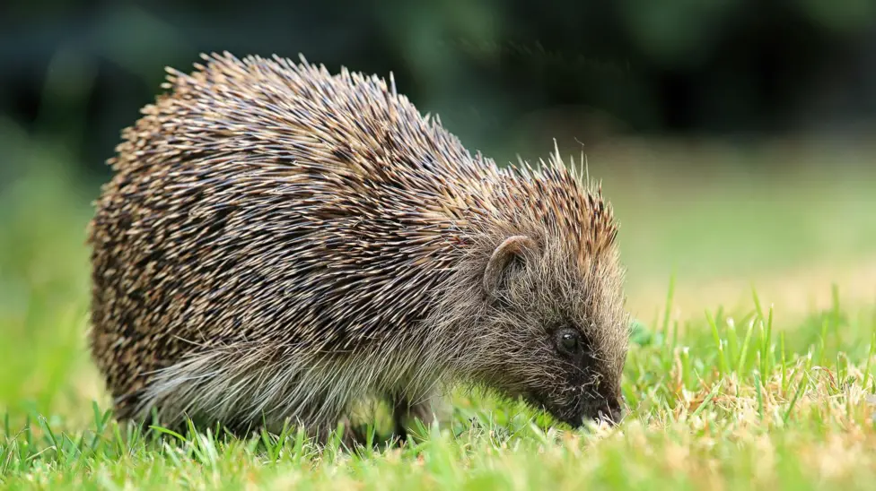
A new conservation initiative at the University of Cambridge is leveraging satellite data and artificial intelligence to address the steep decline in Britain's hedgehog population. An AI tool named Tessera analyses high-resolution satellite images of the UK, enabling experts to pinpoint existing hedgehog habitats and track their disappearance.
Mapping Habitats and Environmental Impact
The resulting maps offer granular detail, down to individual hedgerows, with the AI capable of predicting suitable hedgehog environments even through cloud cover. Project leaders anticipate these insights will illuminate not only hedgehog distribution but also obstacles preventing the animals from accessing food and mates. Researchers state that Tessera's outputs can monitor the impact of new housing developments and other environmental shifts on landscapes crucial for hedgehogs.
This satellite data can be integrated with other information, including real-time movement data from tiny GPS trackers attached to some hedgehogs, dubbed 'digi-hogs'. A similar 'backpack' tracker programme is already operational in Northern Ireland.
The Broader Context of AI in Conservation
Hedgehog populations have seen a dramatic decline across Europe. In the UK, a 2022 report estimated a rural population fall of up to 75% since 2000. The common western European hedgehog, the UK’s sole native species, is listed as 'Near Threatened' by the International Union for the Conservation of Nature.
Professor Silviu Petrovan, strategy and research manager at the People's Trust for Endangered Species, expressed optimism that AI can support the protection of these small mammals. He believes powerful models can help understand specific barriers preventing hedgehogs from finding food and mates, and safely navigating the countryside.
Tessera's Computational Demands and Wider Applications
To accurately identify hedgehogs and other features in image data, the Tessera system was trained on approximately 20 petabytes of data, equivalent to 10 billion standard digital photos. Facing computational limitations, researchers resorted to installing additional processors under their desks. A recent agreement with US technology firms AMD and Vultr has since provided access to enhanced infrastructure.
The extensive, open-source Tessera system extends beyond hedgehog conservation. Professor Anil Madhavapeddy of Cambridge University's planetary computing programme confirmed that over 100 research groups have accessed the tool. It can also be employed to monitor farmland, tracking crop rotation and agricultural patterns across the UK. Madhavapeddy noted the system simplifies complex satellite data, offering user-friendly maps to address specific environmental questions.