Satellite Imagery of Iran Restricted After US Pressure, Raising Concerns
US Pressure Leads to Satellite Imagery Restrictions
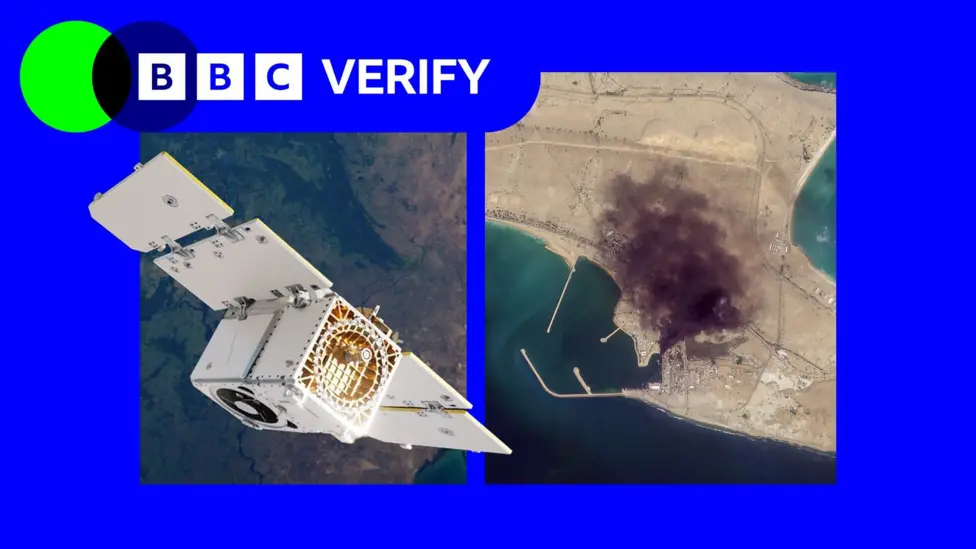
California-based Planet Labs, a prominent satellite imagery company, has implemented indefinite restrictions on access to its imagery covering Iran and a significant portion of the Middle East. This move, which initially began as a 14-day delay in March, follows an unspecified request from the US government and has drawn considerable criticism from humanitarian groups and journalists.
The restrictions severely limit the ability of these organisations to utilise satellite imagery for assessing the impact of conflicts in the region, including damage to both military targets and civilian infrastructure. While the US Department of Defense has not commented on the specifics, Planet Labs initially cited concerns about imagery being “tactically leveraged by adversarial actors.” The company has now switched to a “managed distribution” system, providing selected images “on a one-off basis until the security risk has abated.”
Impact on Journalism and Humanitarian Aid
The extent of these restrictions appears broad, potentially encompassing Iraq, Lebanon, Israel, and Gaza. Satellite imagery has become an indispensable tool for reporters and aid organisations, particularly in conflict zones and restricted environments where physical access is impossible or unsafe.
Investigative journalist Benjamin Strick highlighted its importance for understanding situations where information is tightly controlled. Similarly, Oxfam’s humanitarian lead, Magnus Corfixen, noted how satellite services were crucial for planning logistics and assessing damage to water systems in Gaza, an area now also affected by Planet’s coverage suspension.
Commercial Incentives and Future Outlook
Experts suggest that such “voluntary compliance” requests from governments may be driven by commercial incentive structures, particularly given that companies like Planet Labs hold significant defence contracts with the US and other nations. Bill Greer, a geospatial analyst, observed that the line between voluntary and involuntary compliance becomes “very thin” when the government is a company’s largest customer and regulator.
Concerns have also been raised about the proliferation of fake satellite imagery online in the absence of reliable data. While some news organisations are seeking alternative, non-US based solutions, these often lack the detailed resolution and widespread coverage offered by providers like Planet Labs. Despite the current restrictions, experts anticipate that as the satellite imagery industry expands globally, such limitations will become increasingly futile, making the modern battlefield more transparent for all parties involved.